LIDSTONE GOLD PROJECT
- Located ~240km northwest of Geraldton, ON
- Within the English River Basin proximal to the southern contact of the Uchi Domain of the Superior geological province
- Network of logging roads allows the property access from the west via a truck and from the east via a truck and on foot (approx. 1.5km)
- 16,238 ha of mining claims, 100% owned, no royalties
- Completed 2 field exploration geochemical programs
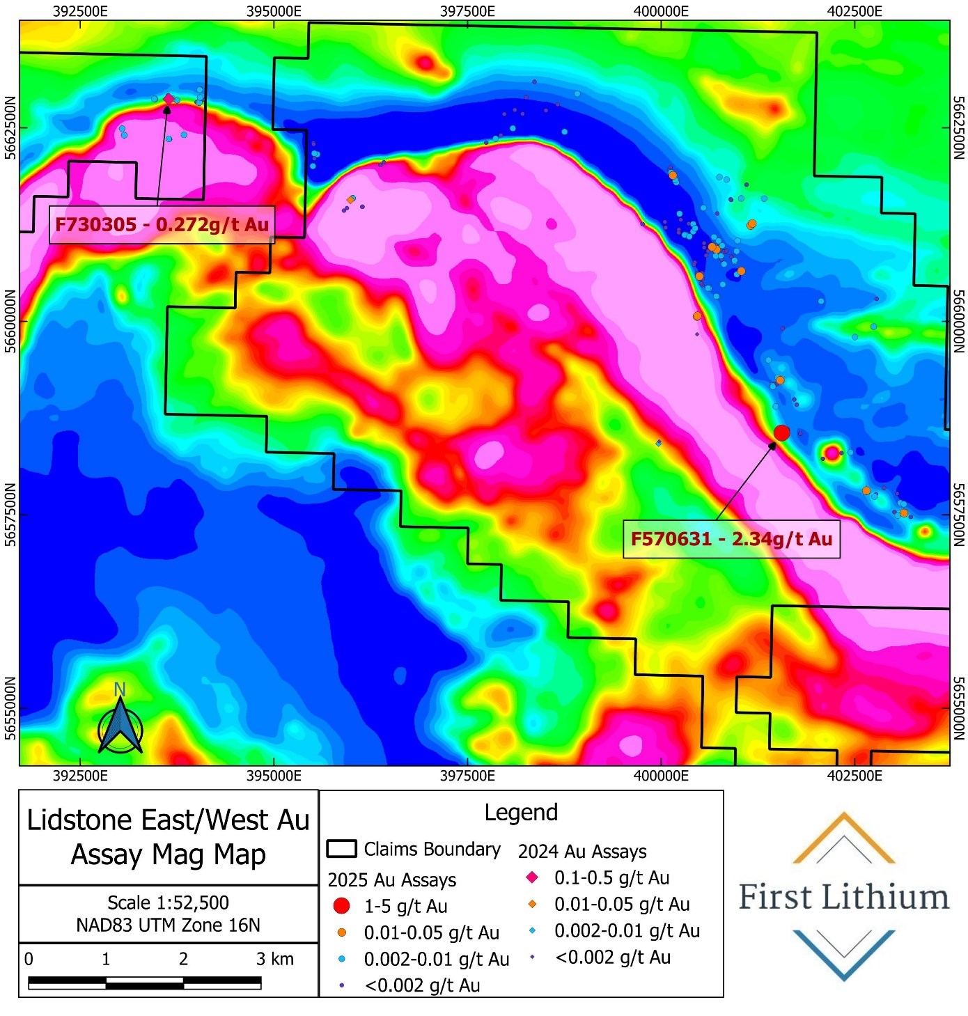
- Quartz vein assays returned 2.34g/t Au (Feb 3, 2026) and 0.272 g/t Au (Mar. 2025)
- Easy access due to extensive network of logging roads
- Exploration to follow up on gold mineralization prospectivity in the 2026 field season

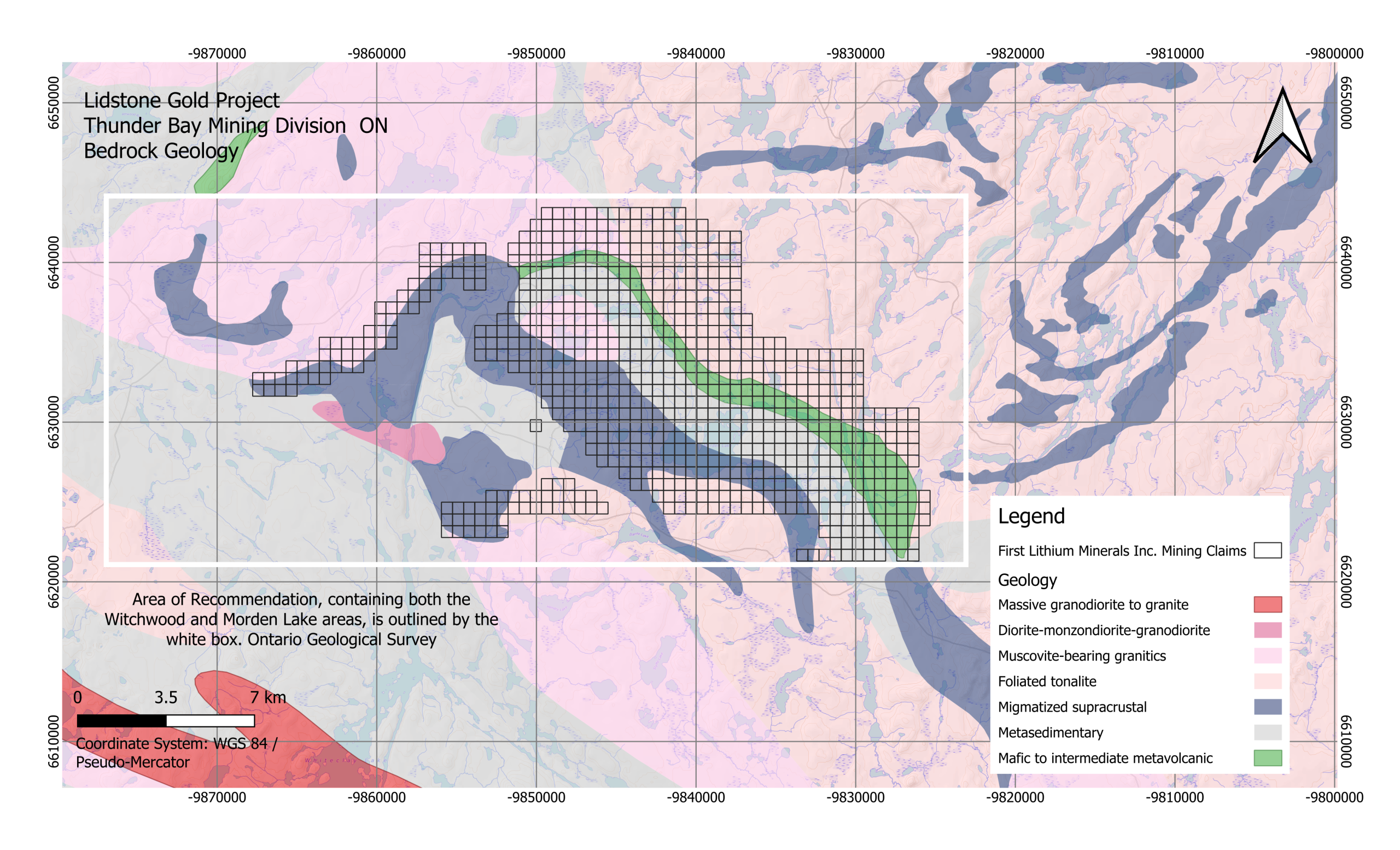
PROSPECT GEOLOGY
- Lidstone is located on the boundary of the metasedimentary dominated English River Basin with the greenstone and plutonic complexes of the Uchi Domain
- Lithologies consist of metasedimentary units, migmatized supracrustal rocks, mafic to intermediate greenstone belt of basaltic/andesitic flows, tuffs and breccias
- Massive to foliated late stage tonalite – granodiorite – monzodiorite suites occur on the northern sections
GEOPHYSICS
- The prospect area consist of coincident magnetic abrupt highs and lows and zones of high electromagnetic (EM) conductance
- Multiple areas of interest suggests historical work overlooked a significant exploration opportunity in the prospect area
- The area shows shear strike that extends north-west through the central part of the prospect with the magnetic high defining the mafic and tonalite units which show high potential magnetic / iron signatures that can be part of a catalyst for Ni-Cu-PGE deposition
- Magnetic data in combination with lithology from historical drilling demonstrates potential scale and prospectivity for a near surface mineralization


GOLD DISCOVERY
- In the 2024 field exploration on the project showed potential for gold mineralization with a sample from a quartz vein returning 0.272 g/t Au
- The surrounding geology was further investigated for potential economic gold mineralization in the fall of 2025
- The 2025 sampling campaign was conducted over ten days in November 2025. A total of 229 samples were collected, representing 102 quartz veins, 112 metavolcanic-metasedimentary rocks, 7 granitic rocks, and 8 mafic-ultramafic intrusive rocks
- Extensive sampling was carried out along the margins of an interpreted granite-greenstone belt contact which is strongly delineated in the regional magnetic survey
- Out of 225 samples twelve samples assayed returned anomalous gold between 0.01-0.05 g/t Au and one sample (F570631) returned 2.34 g/t Au